Tuesday, 11 June 2013

Crambrian Railway


I first came across this while going to Builth Wells. I could not help noticeing little sections of what looked like a former railway. So on looking at the OS map I could see that indeed a railway had run to and from Builth Wells. I felt it was worth looking into what was left.

Add caption


This area used to be the station at Builth Wells


Looking over to the right here you can see the direction the railway went on it's way North


Heading South too you to Erwood Station about five miles away and the railway went along this now cycleway


It would have gone over the bridge below and on along beside the Afon Wye (Afon is Welsh for river)


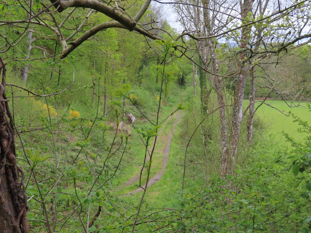
This now farm tack is part of the old railbed


And this is the cycleway heading towards Builth which is on the railbed as well


This is looking from the Erwood road  and the railway is about half way up the photo


This is where the railway ran further near Aberdew


The hedge here is another good indication of the line


along with this old linemans hut


zoomimg out shows the old fence still in place where the railway went


 As the railway go to Aberedw it would have come along this track


and could well have gone over a bridge here which has been removed


 further on it crossed the Afon Edw here


the bridge of which is still in place along with a good stretch of the railbed


Further along the railway went under this bridge


The sides which are still in good condition


after going under the bridge it would have gone towards the gate you see on the right and on to Erwood


It finally gets to Erwood station which still has a weigh bridge


 and station house


along with platform and train though I doubt it ever ran on this line.


a restored signal box


This would have been the crane used for lifting large items from wagons.


You can always have a cup of tea at the cafe here which is now Erwood Station Craft Center and well worth the look around. This is as far as I went in looking at this part of the line. Travelling along the road to Newport you can see parts of the line still in place but I never hand time to visit any of it.  I did cover more of the line going North from Builth Wells and will cover that in another blog. Remember the rusty old train a couple of photos ago well this is how it looks the last time I visited it.


Impressive don't you think


The train had been restored by the Friends of Erwood Station


New information board on the station

The last time I stopped off at the station, I think it has changed a bit since


Further on from the station is a over bridge were the line comes from Broughrood


The line runs along following the river Wye and under a road bridge tat connects to the A470

The line coming from Erwood

Here it runs towards Broughrood I think the bridge is blocked underneath so no way through. I did think I took some photos of the section between Erwood and Broughrood but seems I did not. I will go back and get a few and update the blog again


Sunday, 9 June 2013

Milestones, Benchmarks & Trigpoints


Milestones can be traced back to the Roman Empire where they marked the distance along the roads they built. On my travels round the country I have come across many milestones which can be seen along the roads but what gets me is that none are the same so I will show a few of the different kinds that I have come across.
I have begun to wonder if certain milestones are unique to the road they are on but I will start with the ones local to me on the A329 and we are lucky to have three still around.


This ivy covered one is by the former Fairmile Hospitalin Cholsey


This one near Moulsford reads Oxford 16


 This one outside Wallingford in Cholsey along the A329 has a Bencmark on the top you can see
There are others along the A 329  which can be see and the reason they are in good condition is most likely because they were moved in the war and replaced after.


 This one on the left is a fine example and is by the Black Horse in Gozzards Ford by Abingdon. and is similar to the other on the right at Nettlebed


Though the same can't be said for the one at Bix (above) and
Fairmile in Henley where the wording had been chiseled off in case of invasion in the second war.  The last four I'm sure were on a post road to London.


These two are a different shape again and are along the Bath Road between Reading and Newbury.


In Marlborough the one buy the town hall looks like a headstone


You may well have noticed some milestones have arrows on them, that is a benckmark put on there by Ordnance Survey and marked a particular hight above sea level


Like this one which you can find on a church  Or this one which is on a bridge near Pangbourne, note the number 5, 2,3,&4 don't exist any more but number one is on a water tower in Winchester


The one on the left here is on the Town Hall in Marlborough. The metal ones are called Flush Brackets and the ones cut in the stone cut marks which look like the one below.


One last place you can see a benchmark is on the side of one of these, I triangulation pillar, another of Ordnance surveys markers. So a few things to look out for if you are out for a walk. The milestones and Triangulation pillars tend to be marked on an OS map the bench marks I'm afraid you will have to watch out for.