Wednesday 26 December 2012

A Boxing day Walk


I felt I needed out of the house for a walk on Boxing day, too much Christmas dinner had taken it's toll. I thought I'd have a walk round the footpaths that skirt the village Cholsey I live in and have a look at some of the flooded fields I could see when driving down the Westfield road. First port of call was the Bullshole a place I had spent many childhood hours playing in the brook.


Not quite the Bulls hole but Cholsey Brook which the Bulls hole joins over on the left.


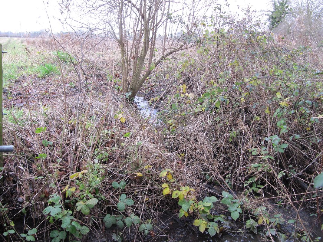
Cholsey brook again where it flows under the bunk line, the bunk line is an old railway which ran from Cholsey Station to Wallingford. Beaching closed it in 1961. This part of the brook was culverted sometime in the 1960's. The brook normally flows about 30cm lower than it is at the moment.


The Bulls Hole which most likely got its name from the cattle that used to drink here. As children we used to play and paddle in the water during the summer taking picnics to eat. It's fed from the brook further near the Lees in Cholsey and runs the edge of a field before running through a culvert under the main London to Bristol Railway (GWR) which can be made out in the photo. Cattle no longer graze in the field so the Bulls home has become very over grown now.
If you carry on along the footpath by the brook you will come to a long tunnel under the railway which will bring you out at position where you can take the footpath to either the Lees or across the fields to Lollongdon.


The railway embankment  the tunnel went through is over on the left in the distance, you cross a paddock then over the brook again before reaching this is the muddy footpath which looks like it was flooded a couple of days previous.


Further along the footpath you cross a track then follow a hedge past the pylon you see in the distance. This is looking back the way I came and the house over on the left is Little Lollingdon


After going through a hedge you will need to go along this footpath which as you can see is quite flooded


and over to the left you can see the field is flooded as well with seagulls feeding in the shallow water. The floods can be seen from the Westfield road as you drive down.


Crossing a drainage ditch you can hear water running and looking see the water draining from the fields into the ditch.


The ditch which will flow eventually back into Cholsey Brook, the plank I think may be part of the old bridge that was here.


Walking on past Lollingdon and up the hill you can get a good view of the Manor which is one of the few Moated Manors country and is mentioned in the Doomsday Book.
 Near the track you can see some of the trees which have had carvings done over the years, I wonder who MG 1959 is?
 From here you can get a good view of the flooded fields which are just outside Cholsey.


I headed back down the hill to take the bridleway back to Cholsey  but it is worth stopping for a look at Lollingdon Manor. 


 Along the bridleway you will pass Lollingdon spring which is where Cholsey Brook rises and is fed by the water that filters through the chalk from the downs


If you look you can see the water bubbling up through the bottom.


From the springs you walk along the bridleway to Cholsey past Westfield farm
 and go along this part of the bridleway where you come out


 at these farm buildings which have now been made into these two sets of units.


 The barns once looked like this and were in the stage of nearly collapsing with a couple which did just that.


 After following Cow Lane a short distance you get back on the bridleway which has this ancient ditch beside it, on the other side it is rumored  there was a nunnery and later the Abbot of Reading had a summer residence there.
Carry on the bridleway past the Elms and Pancroft Farm which was over on the right there, now it looks more like a scrapyard with old cars and trucks laying round the place. Behind me out of site is a bridge which takes the Main railway across the bridleway where you walk under to come back out at Westend in Cholsey. That was one of the short walks you can take in Cholsey, I will write another on a later date.

Sunday 21 October 2012

The Nant Y Gro

This is the Nant Y Gro taken from the opposite side of the Reservoir it feeds into

 
Nothing remarkable looking about it just a tree filled valley with a small stream running through but it had a big part to play in the history of WW2.
The Nant Y Gro fed into the river Elan and was dammed up to form a reservoir to give a water supply to the Navvy Village that sprung up near by when the Caban Coch dam was built. The water supply also filled tanks which were used for the steam cranes, stone cutters and other steam driven plant which was used on the dam. Once the Caban Coch dam was finished the old Nant Y Gro dam was left and the Temporary Navvy Village had become a permanent stone village at Elan and had it's own water supply. 
It more of less became forgotten untill the the government requested the use of a 35ft high dam for secret experiments (can you see where we are going).
This was what the dam looked like in 1942 though in this photo it is slightly damaged after one of the experiments.
The reason for the experiment were to find out how breach the Rurh Valley dams in Germany, the Nant Y Gro was going to be blown up. After a few tries a various depths and distance they finally breached the dam.
From that the Bouncing Bomb that Barns Wallis designed was derived  and the Dam Busters name was born. The rest is history as the raid was successful and the Rurh Valley dams breached though with some loss to the planes involved.
When I found out about this place and where it was situated I'm afraid there was no stopping me, I had to visit the dam.
The opportunity came one day when I was staying at Fforest Fields campsite and went to the Elan Valley for a visit 

This is a map of the Elan Valley today, the Nant Y Gro is and the bottom, as you can see it is not an easy place to get to now let alone what it was like during the war which was one of the reasons for it's use, the remoteness.
The first place you need to go is the top of this dam, take the footpath across the bridge here then climb the steps.


Next you will be following along the side of the reservoir on paths like this and up the steps.


The walk took longer than I thought it would due to the terrain you have to walk across but it was worth the effort.

you will eventually come to the mouth of the Nat Y Gro.


 This is the approach to the dam, you can see one of the water tanks ahead, go to the right for a view of the remains of the dam.


One of the water tanks that was used during the building of the Elan Dams


The remains of the dam today


One side of the dam and from behind the wall

 View to the other side of the dam and below one of the water tanks.
I had intended to go back but as yet have not managed to but one of these days I will as I would like to have a better look round and get some more photo's. If you go to the link Elan Valley it gives you a better history about the place and if you have time visit the church marked on the map near where it says 255. At the back are some photos taken when they built the dam, the church was built around that time as the other is at the bottom of the reservoir.
One last photo, about a year later I was at Brooklands Museum and came across this.


The bouncing Bomb. With out the Dam at the Nant Y Gro it would never have been developed and possibly the war would have gone on that bit longer, so the little dam in Wales had played it's part history of the war but and now lay's almost forgotten but not by me.


Saturday 20 October 2012

The Upper Thames Stopline Part 2

This section will take you from Radcot Bridge to Lechlaid though I have to admit I did it is two parts, the first at Kelmscott and the second Buscot. The Thames path will take you past all but two but I will mention these when I get to them. All the pillboxes in this section are Type 22's
I'll start at the first one you can see at Radcot.


From the bridge follow the Thames path and this is what you will see on the other side, it can also be seen from the bridge. I never visited it though I have no doubt if you ask you will be allowed.


Follow the path further and you should see this one come up on your right, and it is one of the cleaner ones I've seen.


You pass Grafton lock and a little further along you will see this pillbox, this is slightly being undercut by the Thames and does get flooded


Going on towards Kelmscott you come to another very close to the Thames and has a tree growing beside it. Kelmscott has four pillboxes near it.


 This is the second which you can see from the last pillbox.


Heading on towards Kelmscott you will need to head off the Thames path  and go towards Kelmscot Manor and just along the track on the left you will see this one which is the first that is not on the Thames path.


 Head back to the Thames path and go towards Buscot and after about half a mile you see this pillbox. You need to  watch out for Kilroy though.


This next one is about a Kilometer on though I came from Buscot to visit it. The top is braking up along the join but it is possible to get inside to look.


Next along is the first of the Buscot pillboxes, not sure it leans as much as in the photo but does have a number like the last one did.


The  next one I only just managed to spot it through the trees. when I first visited, It was situated on the Thames Water treatment plant.A while later I found out the property had been bought by a local  boat chandler who allowed me to visit


 Going on from Buscot Lock you will pass this pillbox.
As you can see it is a little worse for ware and I'm thinking it was used for target practise like a few others I have seen.
Inside it's very beaten up where the
concrete has been blown in and looks even worse than outside.


The river meanders from here to Lechlaide like it has all the way from Oxford so follow it to St Georges Lock and between there and Lechlaide you will see this pillbox across the river.


The last of the pillboxes I had come looking for though I am told there is one more to get near Cricklade. This ended a what turned into an epic that started with a couple of pillboxes near where I lived and turned into a hunt that went from Theale to Lechlaid looking for all the pillboxes that were left. I have started the Blue line along the River Kennet but have only just got as far a Newbury.

Friday 19 October 2012

The Upper Thames Stopline Part 1

This stars the other side of the Thames from Appleton Common. My first walk was from Duxford with the Rural Explorer, we had hoped to see quite a few pillboxes but it turned out a disappointment with some due to the overgrown state of the riverside. I'll split the blog in to two parts with this one finishing at Radcot.

The first one you come to from Appleton Common is this one.


 It faces upstream towards a bend and is near Stonehenge farm.


 Walking on towards the Rose Revived you will pass this one literally, we did when we walked the other way. I only found out about it from a guy at work so I went back and found it.


 The next pillbox is off a tributary to the Thames, the river Windrush and out of all the pillboxes I have seen it was my favorite as it overhung the river.


 I think I was waiting to hear the bollbox had fallen in a sure enough somtime later I had the news it had gon in the river so I went around to take some pictures. The bank had been undercut so much that it gave way inder the weight and the pillbox slid the rest of the way


Just across the field nearby is another like it along the Thames this photo shows it from the field but it can be seen across the Thames if you walk along the Thames path.

 The next two pillboxes are impossible to see from the Thames path I searched them out on Google Earth then went and asked if it was OK to visit.
It's set back from the river and is surrounded in bushes like this , I came to it from a field and only just spotted it when I was on top of the thing.


 Next along is this one which is set back in a farm at Shifford, I went and asked if I could see it and they were fine and told me where the last one was thought it was on another farm.


 Next along is this one at Duxford to getto the pillbox we paddled across the ford though if you take the Thames path you can keep your feet dry. The pillbox suffers from flooding and was full of smelly water and old refuse sacks. It also has the ricochet wall removed.


 From Duxford you will come to  Chimney Meadows where you will see three this is the first.


 You have to love the second with the huge base it is sat on, as you can guess it floods round here, I've seen photo's of it surrounded by water.


This is the third and is inaccessible as it is now a home for bats though I must say it is suffering from erosion unlike the previous two which were in reasonable condition.


 The next you see is one near Tadpole bridge and again it is blocked off so no access. Carry on to Rushley lock and along from the lock there is what looks like the Upper Thames Patrol hut to see.


 The next couple of pillboxes are on the opposite side of the river Thames (Isis)


The next from this one is Radcot Lock though you do have to cross the bridge nearby to see it.


It's been cast using a couple of different types of shuttering and is a bit crumbly, there are also a load of concrete sandbags laying around.


Head from here to Radcot and you come across some interesting Anti Invasion Defense Sites or concrete brestworks.


This is the first which is the longest the second you need to go over the bridge past the pub and it is in the caravan site.


As you can see it is filled in which is a shame, it could have been a gunpit of sorts.


 Just before the bridge you will find this Type 28A which is the only one along this part of the river. over the other side of the bridge is a Type 22 that is in a private mooring.
          

I'll end this blog here and start the next from the other side of the bridge. You can read a more indepth artical on Geograph and see the next section here