The Elan Valley

The Elan Valley is one of my favorite places to go in Wales. In 1893 the valley was dammed to form a series of reservoirs lakes held back by five dams known as the Elan valley Dams. Though much of the surrounding countryside has changed little (apart form wind turbines) the valleys would have been very different before 1890 supporting various community's. This tour will show some of the dams & reservoirs that are there now along some historic photos I have been able to find. As you go through the Blog you will come across various links I have added, these will tell you some of the history behind the place.
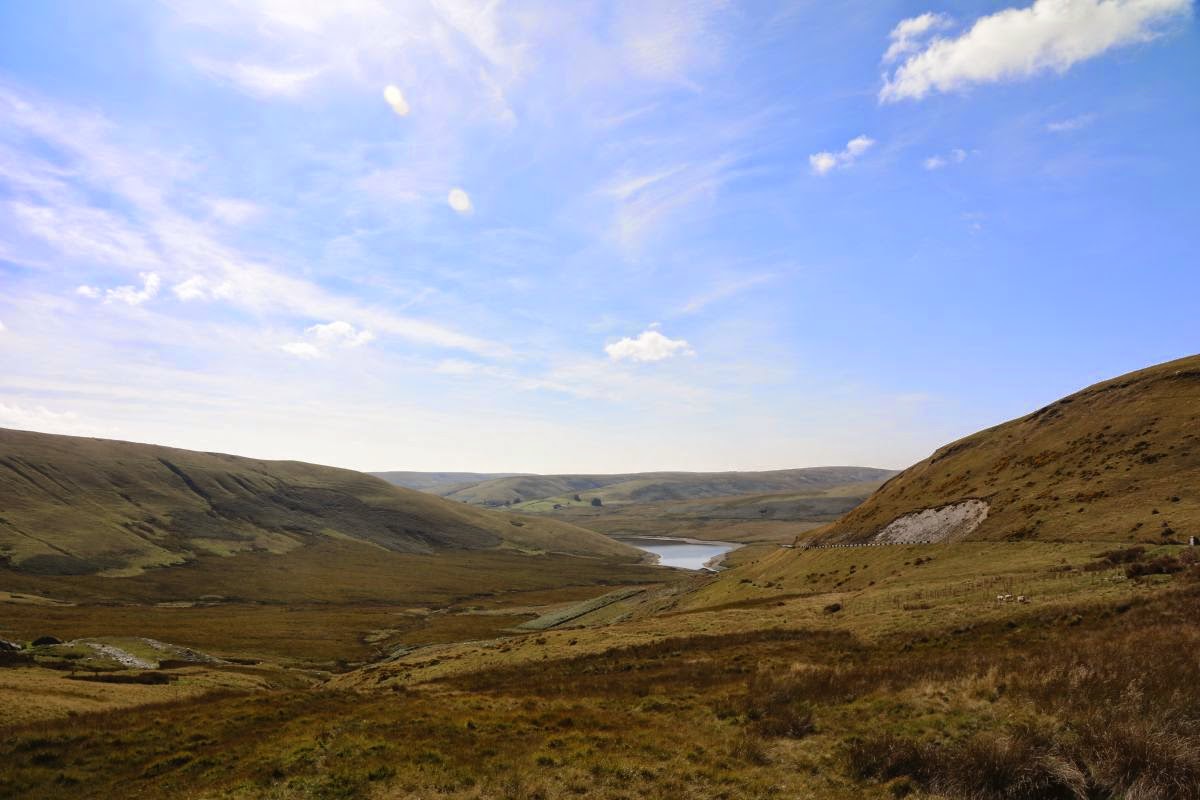
Driving up the Elan Trail from Rhayader and you eventually will come across this view of the head of the Craig-goch reservoir into which the Afon Elan flows

This is the elan winding into the Craig-goch, you can see the water level is low from the dark sides showing

This view looks up the Afon Elan to where it rises in the distance. A mountain road runs nearby which will take you to Aberystwyth. Its well worth a dive along.


and this is the Afon Elan looking very tranquil
This shows the Elan twisting through the Valley

and this is the Afon Elan looking very tranquil

No not the bridge you drive over now though you can walk over it. This was the old road you came across before the made a new steel bridge which I am stood on to take the heavy traffic of today. The bridge your looking at is covered in cracks and looks worse then when I first saw it

Driving along the road following the Elan you will see this view of the Craig-Goch dam come into sight

Look round and you get this view back to where I took the first photo

This is a closer shot of the Dam

The Dam close up, most times I've been here the water is flowing over the top, when I took this photo I think it was about 3 meters lower than usual

You can see the level of the water on the left and what it looks like when flowing over the top, the photo was taken in 2008
View along the side of the Dam which is 156 Meters (513ft) long and 36
Meters (120ft) high, there is also a hydro electric plant down there as
well

Back of the dam showing the tower

Water flowing over the top

This is another photo taken in 2008 showing the reservoir behind the dam

Driving round the road will bring you to the next dam though I must admit I missed out the chance of getting some photos of the reservoir on the way

This one is called the Pen Y Garrag this one is 161 Meters (528ft) long and 37.2 Meters (123ft) high

The tower on the dam. You can go inside the dam and look out of the windows you see though you do need permission as the gate is locked.

Same dam in full flow as seen in 2008

In case you wondered this is a view from the dam of the reservoir behind

Quite a nice view here looking at the mountains


Driving on round the valley you will come to this dam called the Careg-Ddu. Ok so it looks like a viaduct and as you can see the water is way down.

But check out this photo when they were building the dam


This is how it looked in August 2025

Now you might have noticed some buildings in the old photo and the area looked like this on the map around 1890. I suspect the building below the dam being built was the old Nant- Gwyllit church, the one in the distance is the Nantgwyllt House in which Shelley lived for a time


You can see the lower dam 

This is the Foel Tower and is where the journey starts for the water which is going to Birmingham which is why the valley was flooded in the first place in 1896.

The photo on the left was taken in 2003 by Colin Price and shows the lower dam quite clearly, you can see more of his photos on Geograph

The photo on the left was taken in 2003 by Colin Price and shows the lower dam quite clearly, you can see more of his photos on Geograph

In August 2025 the water was low

You can see the lower dam

This was the first time I have seen the lower dam
The next dam to visit is the latest one built and opened by HM the Queen in 1952 to reach it you need to cross the viaduct of the Careg Ddu


Along the way you pass the Dol-y-Mynach dam which I at the time I did not have any photos so found on on Flickr by Martin Brewster. The photo shows how it looks with the reservoir full

August 2025 I found my way there, the tower on the left has a drain which comes out in the Careg Ddu


Dol-y-Mynach dam and reservoir

one of the spillways

The river bed of the Claerwen looking towards the Caban Coch

This is what the dam looks like in August 2025

The dam from down in the river bed

Another view to the dam up the river bed

This is the Claerwen Dam it's
56 meters (144ft) high by
355 meters (1167ft)long

This shot is from the access road bridge to the farm at the base

The Claerwen Valley

This is what the dam looks like when its spilling over the top back in 2008

Lot of water there, note the bridge near the dam

Well this is looking up from the bridge


The Visitor center is over to the right

This is what it looks like going full bore over the top. I took these a few years ago from the top

and this is looking down

Zoomed in a little to the base
Turn around and this will be the view you get.The last three photo were taken in 2009.
From here we go back to the Elan Visitors center which is where most people start from on the way you
Another place to view as you go along the Caban Coch reservoir is the Nant y Gyro
you can read about it in my Blog
Finally you will come to the visitor centre for the Elan Valley which is dominated by the Caban Coch Dam which is 120ft high
The photo here is taken from the visitor center

The Visitor center is over to the right
The entrance to the visitor center with the centenary statue which remembers the navys who worked & died building the dams.

This is what it looks like going full bore over the top. I took these a few years ago from the top

It was pretty misty down there with all the water vapor even at the visitor center.

Thats my tour of the Elan valley I hope you enjoyed it. The historic photos came from the Powys Digital History Project which is well worth a look round others from Geograph. If your in Wales near the place it is worth the visit. There are also various walking trails you can go on as well.